Technology has become an integral part of modern farming practices. One such innovation that has revolutionized the agricultural industry is the use of agricultural drones for accurate mapping and surveying. These unmanned aerial vehicles equipped with advanced sensors and imaging technology provide farmers with invaluable insights and data to optimize their operations, improve productivity, and make informed decisions. In this article, we will explore the benefits of using agricultural drones for mapping and surveying, the techniques employed for accurate data collection, and the potential impact of this technology on precision agriculture.
Introduction
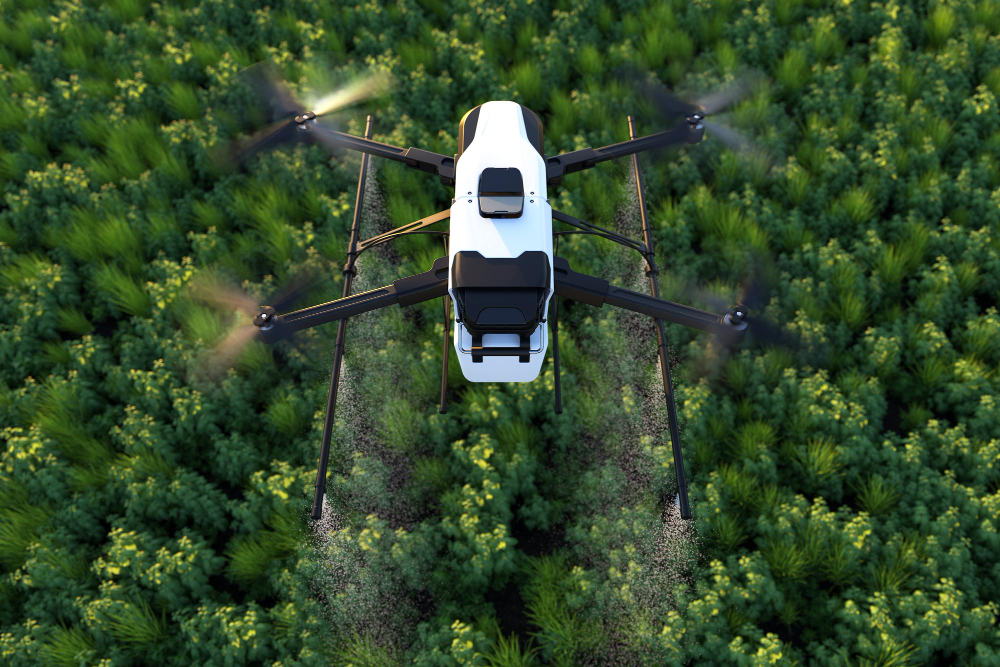
Agricultural drones, also known as UAVs (Unmanned Aerial Vehicles), have gained immense popularity among farmers due to their ability to capture high-resolution imagery of farmland from an aerial perspective. This vantage point offers a comprehensive view of the entire field, enabling farmers to identify patterns, detect anomalies, and make informed decisions for crop management.
Benefits of Using Agricultural Drones for Mapping and Surveying
Agricultural drones have revolutionized the farming industry, particularly in the areas of mapping and surveying. The benefits of using agricultural drones for these purposes are numerous and can significantly enhance a farmer’s operations. Here are some key benefits:
- Cost-Effective Solution: Agricultural drones provide a cost-effective alternative to traditional mapping and surveying methods. Compared to manned aircraft or satellite imagery, drones are more affordable, making them accessible to farmers of all scales. The cost savings associated with drone technology allow farmers to allocate their resources more efficiently.
- Efficient Data Collection: Agricultural drones can cover large areas of farmland quickly and efficiently. With their ability to fly at various altitudes and capture high-resolution imagery, drones enable farmers to collect comprehensive and accurate data about their fields in a fraction of the time it would take using traditional methods. This efficiency allows farmers to make informed decisions promptly.
- Aerial Perspective: Drones provide a unique aerial perspective that offers a holistic view of the entire farm. This vantage point allows farmers to observe their fields from different angles and elevations, identifying patterns, variations, and potential issues that may not be apparent from ground-level observations. The aerial perspective provided by drones enhances the overall understanding of the farm’s terrain and layout.
- Detailed Imaging: Agricultural drones are equipped with high-resolution cameras that capture detailed imagery of the farmland. These images provide a wealth of information, such as crop health, soil variations, irrigation patterns, and pest infestations. By analyzing these images, farmers can gain valuable insights into the overall condition of their crops and make targeted interventions where necessary.
- Precision Agriculture: The use of agricultural drones for mapping and surveying enables precision agriculture practices. By collecting accurate and real-time data, farmers can implement site-specific management techniques. This approach allows for precise resource allocation, including water, fertilizers, and pesticides, resulting in optimized crop yields, reduced input wastage, and improved sustainability.
- Timely Issue Detection: Agricultural drones enable farmers to detect potential issues in their fields promptly. By regularly monitoring their crops from the air, farmers can identify early signs of stress, disease outbreaks, or nutrient deficiencies. Timely detection allows farmers to take immediate action, implementing targeted interventions to prevent further crop damage and minimize yield loss.
- Data Integration and Analysis: The data collected by agricultural drones can be integrated with other farm management systems and technologies. By combining drone data with information from weather stations, soil sensors, or yield monitoring systems, farmers can gain a comprehensive understanding of their farm’s performance. This integration enables data analysis, trend identification, and data-driven decision-making.
- Improved Safety: Agricultural drones contribute to improved safety on the farm. By utilizing drones for mapping and surveying tasks, farmers can reduce their exposure to potential hazards and risks associated with manual labor, such as climbing tall structures or traversing difficult terrains. Drones provide a safer alternative while still delivering accurate and valuable data.
The benefits of using agricultural drones for mapping and surveying are substantial, ranging from cost savings and efficiency gains to improved decision-making and precision agriculture practices. By harnessing the power of drone technology, farmers can optimize their operations, enhance productivity, and embrace sustainable farming practices.
Accurate Mapping and Surveying Techniques with Agricultural Drones
High-resolution Imagery
Agricultural drones equipped with high-resolution cameras capture detailed imagery of farmland. This imagery can be used to create accurate maps, identify crop health, and monitor the growth and development of crops throughout the season.
Photogrammetry and 3D Mapping
Through the technique of photogrammetry, agricultural drones capture a series of overlapping images that are processed to generate highly accurate 3D maps of the terrain. These maps assist farmers in understanding the topography of their fields, identifying potential drainage issues, and planning effective irrigation systems.
Thermal Imaging for Crop Analysis
Thermal imaging sensors mounted on agricultural drones provide valuable insights into crop health and stress. By detecting variations in temperature, farmers can identify areas of excessive heat or cold, which may indicate irrigation problems, disease outbreaks, or poor plant nutrition.
NDVI Analysis for Vegetation Health
Normalized Difference Vegetation Index (NDVI) is a commonly used technique in precision agriculture to assess vegetation health. By capturing near-infrared and visible light, agricultural drones calculate the NDVI values of crops. This information helps farmers identify areas of low vigor, optimize fertilizer applications, and implement targeted pest control strategies.
Precision Agriculture and Yield Optimization
Precision agriculture and yield optimization are closely linked concepts that aim to maximize crop productivity while minimizing resource waste. Precision agriculture utilizes advanced technologies, data analysis, and site-specific management practices to optimize the use of resources such as water, fertilizers, pesticides, and energy. By adopting precision agriculture techniques, farmers can achieve higher yields, improve crop quality, reduce costs, and minimize environmental impact. Here are some key aspects of precision agriculture and how it contributes to yield optimization:
- Site-Specific Management: Precision agriculture enables farmers to manage their fields on a site-specific basis. Instead of treating the entire field uniformly, farmers can divide their land into smaller management zones based on factors such as soil type, topography, and historical yield data. By tailoring management practices to the specific needs of each zone, farmers can optimize resource allocation and maximize yield potential.
- Data-Driven Decision Making: Precision agriculture relies on data collection, analysis, and interpretation to make informed decisions. Technologies such as remote sensing, aerial imagery, soil sensors, and yield monitoring systems provide valuable data about various aspects of the farm, including crop health, soil fertility, moisture levels, and pest infestations. By analyzing this data, farmers can identify patterns, trends, and potential issues, allowing them to take proactive measures to optimize yields.
- Variable Rate Application (VRA): VRA is a key component of precision agriculture. It involves the application of inputs, such as fertilizers and pesticides, at varying rates across different zones within a field. By precisely targeting inputs based on the specific needs of each zone, farmers can avoid overapplication or underapplication, ensuring that crops receive the right amount of nutrients or protection. This targeted approach optimizes resource utilization, minimizes waste, and promotes healthier crop growth.
- Remote Sensing and Imagery: Remote sensing technologies, including satellite imagery and aerial drones, play a crucial role in precision agriculture. These technologies provide high-resolution images of fields, capturing detailed information about crop health, vegetation indices, and stress levels. By analyzing this imagery, farmers can identify areas of concern, such as nutrient deficiencies, water stress, or disease outbreaks, allowing them to take immediate action and mitigate potential yield losses.
- Real-Time Monitoring and Decision Support Systems: Precision agriculture relies on real-time monitoring and decision support systems to provide farmers with up-to-date information and recommendations. These systems collect data from various sources, such as weather stations, sensors, and satellite imagery, and combine it with historical data and models to generate actionable insights. Farmers can access these systems through mobile applications or web platforms, enabling them to make informed decisions on-the-go and optimize their yield potential.
- Automation and Robotics: The integration of automation and robotics in precision agriculture further enhances yield optimization. Autonomous vehicles, robotic systems, and smart machinery can perform tasks such as seeding, planting, spraying, and harvesting with precision and efficiency. These technologies reduce human error, improve operational efficiency, and ensure consistent application rates, resulting in optimized yields and reduced labor costs.
- Data Integration and Analysis: Precision agriculture involves integrating and analyzing large amounts of data from multiple sources. By combining data from various sensors, weather stations, and historical records, farmers can identify correlations, trends, and patterns that contribute to yield variations. Advanced analytics, machine learning, and predictive modeling techniques enable farmers to generate insights and make accurate predictions about yield potential, allowing for proactive decision-making.
Precision agriculture and yield optimization go hand in hand in modern farming practices. By embracing technological advancements, data-driven decision-making, and site-specific management approaches, farmers can unlock the full potential of their fields, achieve higher yields, and contribute to sustainable agricultural practices. The continuous evolution of precision agriculture technologies will further enhance yield optimization, enabling farmers to meet the increasing demands for food production
Integration of Drone Data with Farm Management Systems
To harness the full potential of agricultural drone data, it is essential to integrate this information with farm management systems. By combining drone imagery with other data sources such as weather data, soil sampling results, and historical yield data, farmers gain a comprehensive understanding of their fields. This integrated approach empowers farmers to make data-driven decisions, plan their operations efficiently, and maximize productivity.
Regulatory Considerations and Safety Measures
While the benefits of agricultural drones are undeniable, it is crucial to address regulatory considerations and implement safety measures. In many countries, specific regulations govern the use of drones, including restrictions on flight altitude, registration requirements, and privacy concerns. Farmers should familiarize themselves with the local regulations and operate drones responsibly to ensure the safety of people, livestock, and property.
Limitations and Challenges of Agricultural Drone Mapping
While agricultural drones offer significant advantages, they also come with limitations and challenges. Factors such as limited flight time, payload capacity, and weather conditions can impact data collection. Additionally, the processing and analysis of large datasets require specialized software and expertise. Overcoming these challenges necessitates ongoing research and development to enhance the capabilities of agricultural drone technology.
Future Trends and Advancements in Agricultural Drone Technology
As technology continues to advance, the future of agricultural drone mapping holds immense potential. We can expect further improvements in drone endurance, sensor technology, and data processing algorithms. Integration with artificial intelligence and machine learning will enable drones to provide real-time analytics, predictive models, and autonomous decision-making capabilities. These advancements will revolutionize the way farmers operate, making agriculture more efficient, sustainable, and productive.
Conclusion
Accurate mapping and surveying with agricultural drones have emerged as powerful tools in modern agriculture. By providing farmers with high-resolution imagery, 3D mapping, thermal analysis, and vegetation health assessment, drones enable precise decision-making and optimized resource allocation. However, it is essential to address regulatory considerations, overcome limitations, and embrace future advancements to unlock the full potential of agricultural drone technology.
FAQs
- What are the main benefits of using agricultural drones for mapping and surveying?
- Agricultural drones provide cost-effective high-resolution imagery.
- They enable efficient surveying of large areas.
- Drones help identify crop health issues and potential risks.
- How do agricultural drones contribute to precision agriculture?
- By collecting accurate and real-time data, drones facilitate site-specific management practices.
- Farmers can optimize resource use and maximize crop yields through data-driven decision-making.
- What are some limitations of agricultural drone mapping?
- Limited flight time and payload capacity.
- Dependence on favorable weather conditions.
- Processing and analyzing large datasets require specialized software and expertise.
- What is the future of agricultural drone technology?
- Advancements in endurance, sensors, and data processing algorithms.
- Integration with AI and machine learning for real-time analytics and autonomous decision-making.
- How can farmers integrate drone data with farm management systems?
- By combining drone imagery with other data sources such as weather data, soil sampling results, and historical yield data.
- Integrated data empowers farmers to make informed decisions and maximize productivity.


